Scan to see this page on your mobile phone
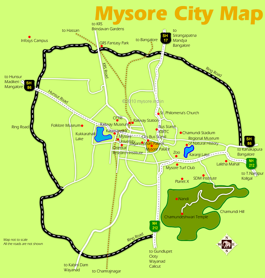
The Outer Ring Road (ORR) or popularly known as the Ring Road is a 32km long 4 lane highway like road that encircles Mysore City, except for the break at the southeast quarter, where the Chamundi Hills is located.
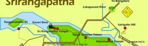
The road networks of Mysore city is in a gridiron fashion with numerous parallel roads "grids" the city. And then there are some 5 radial roads, all originating from Mysore Palace, which is the focal point of the city.
These radial roads are essentially the highways that connect Mysore with neighboring towns and cities.
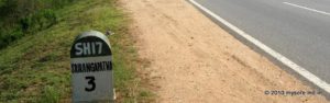
All these highways intersects the Outer Ring Road at some point ( about 5km from city center). For example at the north most point the Outer Ring Road intersects the Bangalore Mysore highway (SH 17) near the Columbia Asia Hospital.
Further west, the Outer Ring Road crosses the KRS Road near GRS Fantasy Park.
Outer Ring Road crosses the industrial suburb of Mysore (KIADB Industrial area) and crosses the Hunsur Road (SH88). Towards the south the Outer Ring Road joins NH212 (Ooty Road) at the foothills of Chamundi Hills. Before that the ORR cross the HD Kote road (SH33), which is another radial road out of the city center.
The whole stretch described above is about 32km long (4 lane most part).
The ORR on the eastern side is shorter but 4 lane thought. The traffic too is relatively less compared to the western side of the ORR. This stretch is about 8 km from the Columbia Asia Hospital junction on the Bangalore Mysore Road (SH17) to the Mahadevpura Road. A little before that the ORR crosses the Bannur Road.
The Outer Ring Road serves as a bypass as well as a city road for Mysore City.
If you are traveling from Bangalore side towards Hunsur, Madikeri (Coorg), KRS (Brindavan) , Infosys etc use the ring road as a bypass road for Mysore city. Take right diversion at Columbia Asia Hospital signal.
On the other hand if you are heading towards Ooty, Calicut, Wayanad etc from the Bangalore side , going right through the city is shorter. That is the distance from ring road junction on Bangalore road (near Colombia Asia hospital ) to the ring road junction on Calicut road is bout 10 km right through the city. If you take the ring road around the city , the distance between these same points are about 25km.
The city traffic is typically a relatively high for about 4-6km inside the city. It's busy but fast-moving. In 2-30 minutes you will manage to cross Mysore through the city center.
The bonus is you would get a glimpse of the Mysore Palace too!