Scan to see this page on your mobile phone
Well, this is about the driving directions and distances from Mysore to Kukke Subramanya. There are mainly three road routes to Subramanya from Mysore. Among the three options distances and road conditions varies significantly, especially the road conditions.
The three routes are:
Route A (185km) : Mysore --44km--> Hunsur-- 43km --> Kushalnagar -- 27km --> Somwarpet -- 34km --> Kudraste Junction -- 13km --> Bisle -- 24km --> Kukke Subramanya. (popularly, the Bisle ghat route)
Route B (206km) : Mysore --44km--> Hunsur-- 43km -->Kushalnagar-- 30km -->Madikeri-- 51km -->Sullya -- 38km --> Kukke Subramanya ( popularly called the Madikeri route)
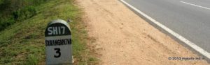
Route C (217 km) : Mysore — 27 km —-> Bilikere (deviation for SH57) — 13km —> KR Nagara — 46km —> Hole Narasipura —33km —> Hassan-- 38km --> Sakleshpur -- 38km --> Gundya -- 22km --> Kukke Subramanya (popularly, Sakleshpur or Shiradi Ghat route)
Route A (Bisle Ghat route): From the distance perspective this looks short, on the map. In fact it is the shortest of the three. But if you look at it from a driving time point of view it is not the shortest. The bottleneck of this route is the 30km or so Bilse Ghat section. From Mysore city you can reach the starting point of the ghat (140km) in about 3 hours time. You'll spend another 2 hours in negotiating the 30km ghat road.
From Mysore city take the Hunsur Road (SH88). It's a 4 lane highway all the way till you take the deviation at Kushalnagar. Just before Hunsur town you'll hit a Y fork. Take the right of the fork to bypass Hunsur town.
Near this junction on your left on the bypass road you'll find the Annapoorna restaurant, a popular halt point. If you are CCD fan, about 18km ahead at Kambalapura there is a Cafe Coffiee Day outlet.
From Hunsur in about 45 minutes you'll reach Kushalnagar. Now you'll leave the highwayYou may need to ask for direction to Somwarpet at Kushalnagar town square. After a few kms of scramble inside the town you'll be on the Somwarpet road. The road now is a curvy and narrow but quite ok to drive.
You'll pass many villages, a forest, many coffee plantations and even a golf course before entering the Somwarpet town. In fact you will need to take a left diversion for Subramanya a little ahead of the town square.
Now onward at every junctions you'll need to ask for the proper direction to Subramanya . You'll find a good number of signboards by the PWD.
If you can not read Kannada, ask to confirm your route. About 7km after Shanthalli village you'll hit a diversion. The left goes towards Pushpagiri mountain and take the right (downward) road. Another 8km ahead you'll hit a T junction at Handalli Kudige. This is practically the Bisle Ghat road.
The right takes you to NH48 near Sakleshpur (38km). Take the left for Subramanya. About 8km ahead arrives the Bisle village and the forest department checkpost with a gate across the road.
The road condition now onward gets progressively worsen, except for the last 8km before Kukke Subramanya town. The road is narrow and curvy along the slop of the mountain. On your left is the formidable mountain wall ; on the right the gorge. Paradoxically this 30km stretch is perhaps the most beautiful and the most difficult to drive stretch of the whole route.
The road is not exactly dangerous; its rather narrow and bumpy. The hairpins and not one of the formidable types one find in the ghat roads of western ghats. The road surface is mostly washed out by the monsoon rains, making the driving a lot slower and bumpy. With car one can manage it though you may encounter an occasional rub on the undercarriage. The average speed is about 15-20kmph for about 20km stretch. Of course KSRTC operates some two trips on this road daily.
Be aware that this is a lonely route. If there is a road block due to a fallen tree or your car had a breakdown, you are stuck. There are no habitation anywhere near. You are in fact bisecting one of the dense and remotest part of the western ghats. Needless to say there is no mobile connectivity for hours on this road till you reach Subramanya. It is very rare to see another vehicle passing, though the same thing can not be said about wild animals! As a matter of prudence avoid driving on this road in the night. Early mornings and evenings can be quite foggy, cutting the visibility to a few feet.
Do not get out of the vehicle in the forest , except probably at the so called "Beauty Spot", a view point maintained by the forest department. This is set on a cliff from where you can see a chain of mountain ranges ( Kumara Parvatha Puspha Giri, Dodda Betta ,Patta Betta and Enni Kallu ) ,the gorge and the Giri River sneaking through the valley beneath. You need to walk a bit from the road to reach the view point. There is a huge hoarding by the forest department by the road at the entrance of the view point.
Somewhere later on the road you will cross a large river ; further ahead almost at the fringes of the mountainous stretch is the shrine of Boodhi Chavadi Chamundeshwari Amma on the banks of a stream. On coming out of the forest you'll suddenly see a lot of inhabited land, mostly of plantations. A few more km ahead is a large junction. Turn left, the town and the temple is about 3km from this junction.
In shot, take the Bisle Ghat route to Kukke Subramanya if you want to enjoy nature at its splendid best, love a mini adventure.... and not in a hurry.
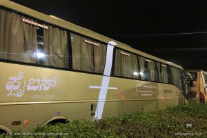
Route B (Madikeri route) : This is possibly the most popular route between Mysore and Kukke Subramanya. Most of the buses to Kukke Subramanya too operate by this route.
It is SH88 all the way till Sullia, where you will take a deviation for Kukke Subramanya. Follow the instructions given in the previous route (Route A) till Kushalnagar. Instead of taking a deviation at Kushalnagar (unlike in case of route A), keep on going on the SH88 till Madikeri town. Like mentioned before the road is awesome with 2/4way lanes.
Somewhere immediately after you've entered the Madikeri town, you need to look for that road diversion to Mangalore from the town square. You are still on the SH88 till you reach Sullia town. This is about 50km from Madikeri town. You've to cross the town and proceed some 2-3km out of the town to find the deviation on your right. You'll find a signboard too directing you to Subramanya. ( A while before Sullia is a Goonadka diversion to Subrahmaniya. This is a narrow route but shorter to Kukke.)
The road now onward is relatively narrow , a lot curvy and with occasional bad stretches. In about 30 minutes, you'll enter the forest section. This road will head straight to the front of the temple. A little before the temple you'll find the parking lot dotted by tourist homes and lodges.
A large number of visitors to Subramanya from Mysore side prefers this route. It's a good choice
Route C (Sakleshpur route) :
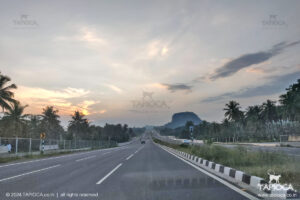
This is a roundabout route to Subramanya from Mysore. Though it is a bit long route, the road condition is excellent all the way till Subramanya from Mysore.
Take the Hunsur road (SH88) out of Mysore city. About 27km from the city you'll see a diversion on the right at Bilikere. There is a massive traffic sign across the road ahead of this junction. Leave SH88 and take the right turn. Now you are on the SH57 towards Hassan. The road now is a neatly done 2 lane, relatively less busy.
You'll cross KR Nagar and Hole Narasipura and reach outskirts of Hassan. At some point before entering Hassan city the NH48 crosses your highway. Turn left (towards Mangalore side) on to NH48. Unlike the stretch so far, NH48 is quite busy, especially with over speeding trucks and cars.
You'll reach Sakleshpur after 38km on NH48, a few km after Sakleshpur the ghat road starts. Sakleshpur is busy town you'll find a few restaurants by the highway side. If you are coffee fan, try Ossoor Restaurant which comes to your right, some 5km before Sakleshpur. This is a great drive in restaurant attached to a large coffee estate.
After about 38km from Sakleshpur, after negotiating the curvy ghat section ( Shiradi Ghat) you will reach a small junction called Gundya. You are still inside the forest and at Gundya is a forest department check post. Turn left , leaving the highway.
The road zigzags through the forest section for another 22km before you reach Subramanya town square. Parking lot is a little ahead of the temple location.The road is in good condition all the way. So if you don't mind driving some 20-30km extra, try this route.
Route B is the most popular route.
Try Route A if you are a bit adventurous.
So that's it about driving to Kukke Subramanya. Safe & Happy driving!!!