Scan to see this page on your mobile phone
The descriptions here is about the "Route A" and "Route B" of the options mentioned in Mysore to Wayanad route map, both are to Mananthavady town. For "Route C" see Mysore to Sulthan Bathery.
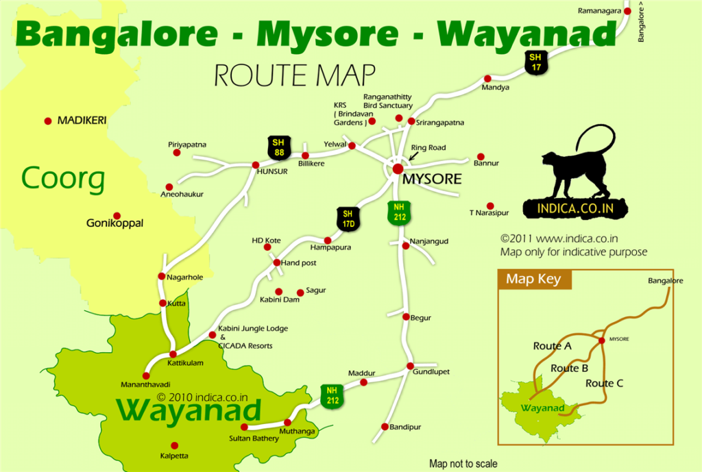
"Route A" is essentially a 130km drive from Mysore City to Mananthavady town in Wayanad (Kerala) via Hunsur, Nagarhole and Kutta. While "Route B" is 115km drive from Mysore to Mananthavady via HD Kote, Nagarhole, Bavali. Both are totally separate routes till they join at Kattikulam in Wayanad, some 10km before Mananthavady town.
Let's first see the details of "Route A" and later in this page details of "Route B"
Route A:
Of the 130km drive From Mysore to Mananthavady via Hunsur, about 40km is through the forest. That is some 30km through Nagarhole forest (Rajiv Gandhi National Park) on the Karnataka side and about 10 km through the fringes of Begur Wildlife Sanctuary (Tholpatty) in Wayanad.
The route is like this. Mysore City -- 46km --> Hunsur -- 19km --> Nagarhole entry -- 31km--> Nagarhole exit -- 4km --> Kutta -- 2km -->Karnataka:Kerala border --17km --> Kattikulam --10km--> Mananthavady town.
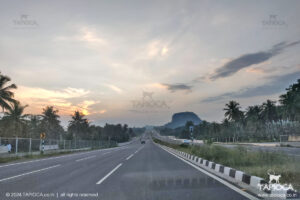
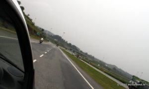
The first task from Mysore is to get to the Hunsur Road (that is the State Highway 88). This road starts right from the heart of Mysore city. After about 8km from the city, the Outer Ring Road crosses the Hunsur Road. From this point onwards the traffic is thin, road is a well made 4 lane and it is a zip all the way up to Hunsur. About 2km before Hunsur town, a bypass road takes off on the right at a Y fork. Take the straight (left fork) to Hunsur town.
Even if you miss this ask for direction to the Hunsur town on the bypass road.
Hunsur is a small town where you'll be leaving the highway for the forest road. From now onwards there are no facilities (hotel,toilet,fuel station ....) available on the till you have crossed the forest and reach a tiny town called Kutta. This town is some 55km from Kutta, and will take about 2 hours considering the road condition and the speed limit inside the forest.
So fill the fuel, get your grub and don't forget to recheck that spare wheel!
Take that left turn immediately after the Hunsur bus station. It is a nondescript junction that one can easily miss. This is the road to Nagarhole. If in doubt aks for directions near the Hunsur bus station.
The road condition now onwards is nowhere near the one enjoyed from Mysore to Hunsur. Nevertheless the pothole ridden road gets a bit better after a few kilometers. In fact it is a bit narrower, rather than a bad road to drive.
At about 7km after Hunsur you'll reach a junction , the left goes to HD Kote and the right (straight road) heads towards Nagarhole. Take the Nagarhole road. In any case you'll find a signboard welcoming to the Rajiv Gandhi National park and the Tiger Reserve. If in doubt ask. And further reconfirm with another passerby.
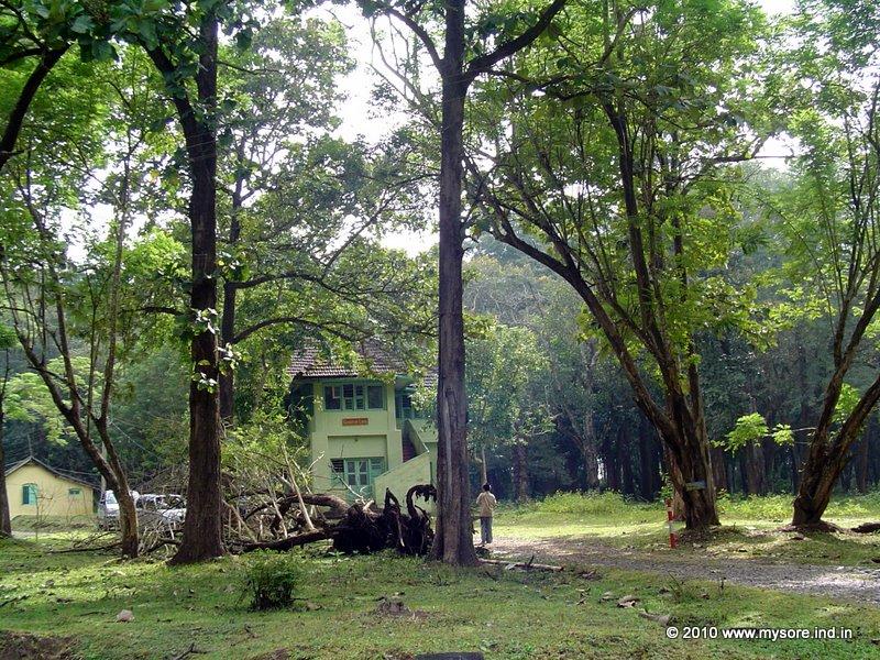
If everything is right in 12km you should hit the entry gate to the Rajiv Gandhi National Park. As a reconfirmation of the route, this is also the same point where "The Kings Sanctuary", a famous wildlife resort is located. You'll see the electric fenced compound of the resort on your right before encountering that forest check post gate across your road.
This gate is always kept closed.
You've to complete certain formalities ( entering your name, vehicle reg, destination, passenger count etc in the register ) at the small check post at the gate.Vehicle entry to the forest is not permitted after 5pm and before 6am. Also two wheelers are not permitted in the forest. The guard will check your car for contraband items as per the forest regulations. So leave those beer bottles at home while packing!
There are no fees to be paid at the check post. However it is not unusual the staff signals for a small tip before lifting that green painted gate.
From now onwards in is pucka forest where wildlife roam freely. Stick to the etiquettes and rules while driving inside the forest, so that it is safe for you as well as safe and undisturbing for the wildlife.
A list of NO's while inside the forest are: No honking, No over speeding, No halting, No camping, No getting out of your vehicle etc. Leave alone the legal side, it's too dangerous to stray into the forest however tempting it is.
If you see wildlife crossing your path, slow down and stop as early as possible. Animals are typically shy of human presence and fade away into the jungle. Wait till that happen. Do not honk or shout as a means to chase them away. Elephants and bisons are known to charge when felt threatened.
Enjoy a slow and watchful drive. You are likely to spot elephants, spotted deers,antelopes,bisons, peacocks and a great deal of wild fouls.
The road through the forest is riddled with speed breaks every few hundred meters. Some 7km after the entry gate, you'll cross Murkal, which is basically a tribal settlement. There is an elephant camp and a forest guest house on the way. You'll see many you'll see many (domesticated) elephants while passing this point. Also here you'll find many branch roads. Stick to the main road.
After about 6km from the elephant camp, you'll get to a junction. The right road goes to the northern border of the forest. You'll continue straight on the main road. A few more kilometers later you will cross the Nagarhole forest office area and the guest houses.
You'll also cross the "Safari Point" which is also the tourist hub in Nagarhole. The Nagarhole safari starts from this point.
About 31km after the entry gate, you'll reach the exit point of Rajiv Gandhi National Park. Some 4km later you'll reach a small town called Kutta. This is the gateway town to Kerala border and also to many places in Coorg like Irupu Falls, Ponnampet, Gonikoppal and so on. At the town turn left towards Kerala border, which you'll find some 2km from the town. And suddenly the road is both busy and bad. The forest has already give way to plantations. However on the Kerala side you'll again pass through a forest range for another 10km or so.
By the way, when you cross the border from Kutta, you are already in Wayanad.
In about 20km from Kutta you'll hit a small town called Kattikulam. Just before reaching Kattikulam , you will pass that entry point of Tholpetty (a wildlife sanctuary on the Wayanad side) on your left and the deviation (on your right) for Thirunelli Temple and Pakshipathalam (a popular trek point).
At Kattikulam town the road ends into the main road to Mananthavady. This is also the same point where the "Route B" joins. Turn right to Mananthavady town or turn left for Kuruva Island , both are about 10-15 minutes drive from Kattikulam. From here onwards your route is based on your itinerary and destination in Wayanad.
You've crossed the forest , reached the destination and not driving anymore, it's time to look for a substitute for that forsaken bottle of beer!
A word of caution for your return journey. Let the indulgences of Wayanad not come in the way of hitting the Nagarhole forest entry point before the night restriction start. Get to this point well before 5pm. What this means is start from Mananthavady town the latest by 4pm. In about 1 hour time you cross Kutta and reach the check post gate of Nagarhole forest.
For any reason if you have to drive in the night, there is an alternate route from Kutta to Hunsur. You will essentially circumvent the Nagarhole forest (without entering the national park) along its northern fringes to reach Hunsur via Ponnampet and Gonikoppa. This is about 82km. In other words some 27km more than the distance to Hunsur through Nagarhole. From Kutta town turn left to Ponnampet (30km) then to Gonikoppa (6km) and to Hunsur (44km). Keep in mind this is hilly terrain and the road condition is not all that great especially during the rainy season.
So that's it about Route A.
Now let's see the other alternative to Mananthavady from Mysore.
Route B:
This route is a bit shorter than the above described route, and obviously the quickest too.
For many years this route was a nightmare for driving , thanks to the broken road stretches. Not anymore, baring a few km stretch (2km bad; 12km not that great ) in the forest, this route is very well maintained.
The distances for Route B are : Mysore City-- 49km -->HD Kote (Hand Post Jn)--27km--> Nagarhole entry-- 22km --> Nagarhole exit (Bavali/Kerala border)-- 7km -->Kattikulam --10km--> Mananthavady town.
So from Mysore city, the first task is to hit the HD Kote road (also called Mananthavady road). Get to the JLB Road from the city and head southward (towards Chamundi Hills direction). Near the Mysore Silk Factory you'll find a large junction and the HD Kote road on your right. After a few kilometers You'll cross Ashokapuram (railway line) and the Outer Ring Road.
The HD Kote Road crossing the ring road also marks the exit of Mysore city. The whole thing suddenly turn rural as you cross the ring road junction. From this point 41km later you will hit a big junction called the Hand Post. The right branch from Hand Post circle head for HD Kote. But you'll take the straight road towards Kabini.
By the way this junction is where you can fill fuel (there is a fuel station just before the junction ) and take a break for light snacks. The next possible such place is Bavali or Kattikulam, all located some 60km beyond this point.
Some three kilometers after Hand Post circle , the road will hit the so called Kabini junction. The left fork (rather the straight road) head for Kabini Dam and also to the famous Orange County at Kabini. Take the right (curvy) turn at this junction for Mananthavady.
If you are not careful at this junction you will easily miss deviation and head towards Kabini. At this junction there are many signposts, mostly of the Jungle Lodges, Kabini River Lodge,Cicada Kabini, The Bison tented camp resort etc; all are in the direction of Mananthavady.
After about 6km from this junction, you'll cross a large village and further 6km you'll find a closed gate road across the road. The signboard reads Rajiv Gandhi National park. This is also officially the end the good road! Earlier the traffic was allowed to go through the national park. Now you have to take the deviation to circumvent the national park to some extend. So take the left tun. Here too you'll find the sign boards of all those wildlife resorts mentioned earlier. You too have to follow the same direction to a certain point.
The road now is a lot narrower and it will snake through many hamlets and villages. After about 12km from the above mentioned gate, you will see another gate across tour road. This is another entry to the Rajiv Gandhi National Park ( also called Nagarhole). The guard manning the check post will open the gate. Now you are into the jungle proper. This is also the safari route for those wildlife resorts. You'll see many safari jeeps on this route, especially in the mornings and evenings, that is the ideal time for wildlife spotting.
By the way some two kilometers from this point the road is really bad. But you can drive slow and manage the stretch in about 20 minutes. It's more likely you will spot wildlife and may want to drive slow.
The so called bad stretch soon ends at a junction. On the right you'll see a closed gate. Turn left for Mananthavady. From now onwards the road is great again. Every 500 meters or so you'll spot two sign boards, one warning of speed breakers and the other of wild elephants!
True, be careful of elephants and other wild beasts. You are going to be in this dense forest for another 20km till you exit the forest at Bavali. Getting out of you car is not at all prudent inside this forest. Just drive at a slow speed and watchful of any animal crossing. Like mentioned somewhere above, just allow the wildlife give you way. You many not encounter that elusive tiger, but the bisons and the many bull elephants are something to be careful of while driving through the forest.
This is one of the most scenic forests stretches of Nagarhole forest. Also on the way, inside the forest, you can see many tribal settlements.
At Bavali, you will leave the Rajiv Gandhi National park and immediately after that arch is the Kerala border. Turn right towards that black and white stripped bridge. The gate opens. Cross the bridge and you are in Kerala, to be specific in Wayanad. On the kerala side are a series of check posts (RTO, Commercial tax etc). Going past that you are into the forest again, this time on the Kerala side. The road is good, but you'll notice the sudden increase in the traffic and population on crossing the border. Some 7km later you'll hit Kattikulam town, a little before that the deviation to Kuruva Island on your left. Mananthavady is at a distance of 10km from Kattikulam.
In short Route B is about 115km from Mysore via Bavali. Baring those 12km roundabout at the forest, the road condition is great all the way through. If this fits well with your itinerary, this is a great route to reach from Mysore to Wayanad.
The distances mentioned are approximate.