Scan to see this page on your mobile phone
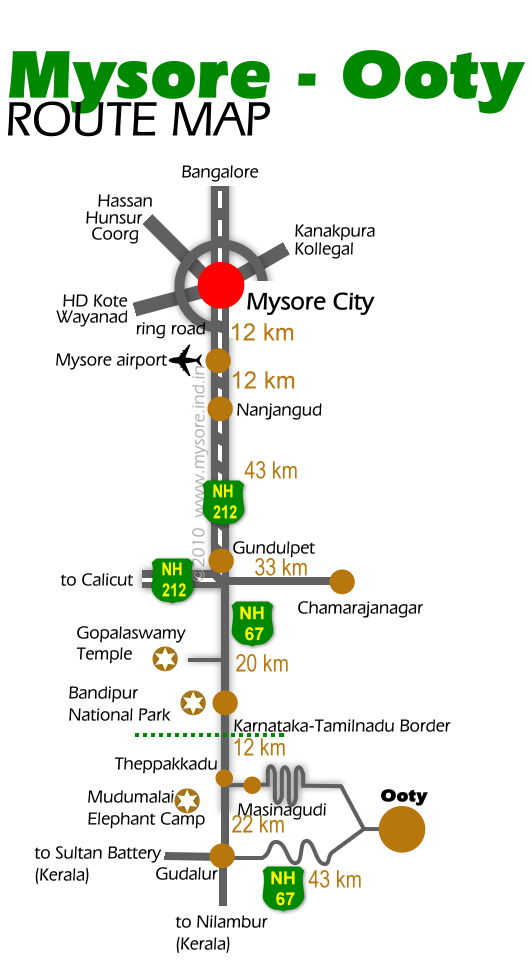
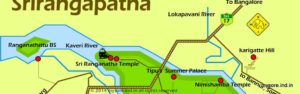
To drive to Ooty from Mysore, the first task is to get to the Nanjangud road. This is nothing but the Calicut (Kerala) bound NH212, also called the Nilgiri road. This starts from the southeast part of Mysore Palace compound. You can also take the JLB Road or the Outer Ring Road , both joins the NH212 in the outskirts of the city.
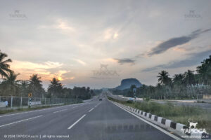
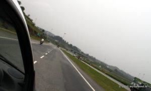
Traffic from Mysore to Nanjangud is relatively high thanks to those numerous trucks and the buses on this stretch. Further from Nanjangud up to Gundlupet the traffic thins down. Nevertheless this too is a busy route.
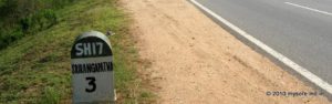
Immediately after the Gundlupet town the highway makes a broad right bend with a left fork (rather a straight road) branching out. This is the starting point of NH67. The right leads (NH212) to Calicut. Take the straight road (ie NH 67) that heads towards Bandipur and Ooty. In short you are leaving NH212 at Gundlupet and countinue to Ooty on NH 67.
If everything went well you should reach this point in about 1½ hours from Mysore city.
After about 20-30 minutes you’ll hit a village called Hungala. Take the right deviation for the popular Gopalaswamy temple (popularly Himavad Gopalaswamy Betta).
After about 4km from the deviation arrives the Pugmark Restaurant on NH67 operated by the Jungle Lodges. The easy landmark is a shrine in the middle of the highway where the road makes a split around it. The Pugmark Restaurant will appear on your left after about ½ km from this shrine.
Another one more kilometer you enters the Bandipur National Park.
In one stork the whole surrounding changes.
Now your drive is through the forest. The road is now in decent condition, though you are restricted to drive slow while inside the forest. There are quite a few rules to be followed while inside the forest. Do not get out of your car. Halt well ahead to give way if you find wild animals crossing your path. Don’t honk and so on. In short safely cross the forest without disturbing the wildlife.
A little ahead after the forest entry gate, the road bifurcates making it into a one-way road. After this rejoins (some 2½ km later) you’ll pass the Bandipur’s tourist center. Those heading for Bandipur as a day trip from Mysore end up here to take the safari. There is a forest outpost and a gate nearby.
About 8km from the safari point is the Karnataka Tamilnadu border. A bridge across the stream marks the state border. An arch welcomes you to Tamilnadu. Around the bend is the check post of Tamilnadu.
Though it is the a contiguous forest, on the Tamilnadu side it is called Mudumalai National Park.
About 5km from the border you’ll reach a place called Theppakadu. This is the place the route to Ooty via Masinagudy deviates from the NH 67, that heads to Ooty via Gudalur ( see Mysore to Ooty via Gudalur ).
The main traffic to Ooty (bus,trucks etc) goes via Gudalur. However the adventurous ones can take the Masinagudy route. You’ll find the safari point, forest guest houses and even an elephant camp ( Mudumalai Elephant Camp) near this junction.
For Masinagudi you’ve to take the left turn at Theppakadu, leaving the NH67. The easy landmark is a big arch bridge across the river on your left. This bridge called Ari Gowder Bridge. It was constructed in 1939 and named after a popular leader of the region .
7km later you’ll reach Masinagudi. This is a very popular destination among trekking fans and also popular for the many resorts/home stays around. Baring the Masinagudi village limits, you are very much in the forest region. About 6 to 8km later you’ll hit the ghat section known for the formidable steep climbs and hairpin bends. You’ve to negotiate some 36 of them that appears one after another in quick succession on a narrow uphill road. Not for the week hearted (car,driver and the co passengers included!).
For about 15km you’ll be on the first or second gear while climbing and negotiating those hairpins. If you fumble and the engine stops, your car will start sliding downhill.
The uphill vehicles are given priority (give way) especially while negotiating the curves. Vehicles in the downward direction stops well ahead of the bends allowing the climbing vehicles take the turn easily, though the road at the bends are relatively wider.
If you thought climbing was tough, you will be proved wrong when taking this road while returning from Ooty.
Keep it on the first,second or third gear while climbing down. This is the best control than relaying on the break alone. First of all the breaks may not stand for such intense load given the road is too steep and that too for such a long duration (10-15km). It will get heated up and may get jammed , or even worst, fail altogether.
By the way the Masinagudi route is closed for traffic in the night.
At the end of the ghat you’ll reach a place called Kalhatti , you can stop here to watch clouds at your level or even beneath. A short detour (3km to right) from this point can take you to the Kalhatti Falls. Otherwise Ooty town is 10km away.
So that’s it about the driving directions from Mysore to Ooty.