Scan to see this page on your mobile phone
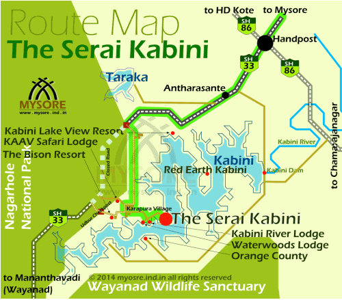
The Serai Kabini is located on the north banks of the Kabini reservoir on the edges of Nagarhole National Park. Mysore to Serai Kabini distance is about 80km, oriented southwest of Mysore city.
Take the SH33 from Mysore to Mananthavady. At Karapura village on the fringes of Nagarhole forest,take a diversion to Serai.
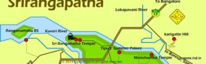
Mysore to Serai Kabini route (distance 80km) : Mysore —>48km–>Handpost Jn (straight) –>3km–>Kabini Dam diversion (turn right)–>12km –>Rajiv Gandhi National Park Gate (Closed) (turn left) –>10km–>Karapura Village square (turn left) –>2km–>Cross Roads (turn left & then right) –>1km–>The Serai Kabini
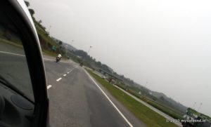
From Mysore city get to the SH33 (also called the HD Kote Road or Mananthavadi Road). You can take the JLB road from the city center, or the Outer Ring Road that goes around the city to get to the Mananthavadi Road.
About 48km of drive from city will bring you to a busy village square called Handpost. Cross the junction straight, you are on the way to Mananthavady.
About 3km further you'll see a left diversion for Kabini Dam. Take the right (highway) and keep driving till you hit a closed forest checkpost gate across the highway, the entrance to the Rajiv Gandhi National Park.
Traffic through the park is restricted, hence the gate is kept closed . You'll have to leave the highway and turn left, located just before the park gate.
Now onward the road is narrow and bumpy till you reach the Serai. Once you are on this diverted road, you will cross through a couple of villages and hamlets.
About 9km from the park gate diversion, you'll reach a village called Karapura. Turn left. In 2km you'll hit a cross roads.
The straight road heads to the legendary Kabini River Lodge by JLR. Turn right for Waterwoods Lodge.
Serai is 1 km from this junction. From the junction turn left and shortly again right, you are at Serai on the banks of Kabini.
A note to estimate driving time. You're likely to reach the national park gate from Mysore in about 1hour time (60km). And the last 20km (diversion route) would take about 30 to 45min of drive on narrow road through villages.
You may also see the details on other Kabini Resorts.
Happy Holidays!